
[This was originally published to our subscribers during our passage from San Diego to the Marquesas.]
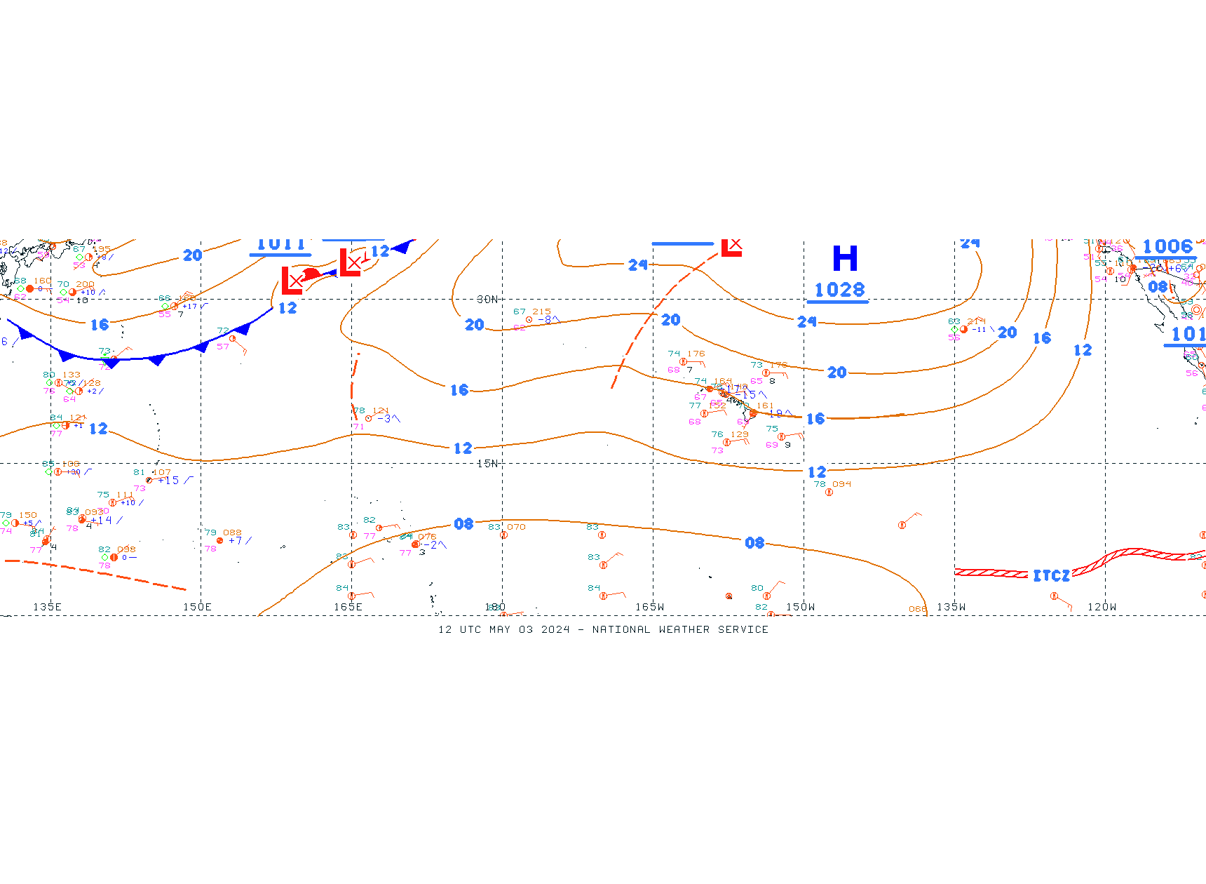
A few of you have asked how I’ve chosen our route to French Polynesia, and the truth is, it’s mostly been chosen for us by the same winds that chose the routes of ships four hundred years ago. If you look at our PredictWind tracker, you can see the general wind trends of the Pacific. Winds blow down the west coast from the northwest, until you hit the northern hemisphere tradewinds, which blow from the northeast toward the west. Just north of the equator, there’s a band of light and variable winds with frequent thunderstorms, which is often called the “doldrums” in classic sailing literature, but is properly known as the Inter Tropical Convergence Zone (ITCZ). That’s what we’re approaching right now!
Across the equator to the south, everything is a mirror image of the trends in the north Pacific. The south Pacific tradewinds blow from the south-east toward the west. Sailors often call sailing this route across the south Pacific the “Milk Run” or “Coconut Milk Run,” and give directions for it with the ever-quotable phrase “sail south until the butter melts, then turn west.”
While the prevailing winds have determined our general course, I make day-to-day decisions about our route. I spend no less than three hours every morning downloading and studying the forecasts, determining our course and speed averages, and plotting an estimated course ahead. I’m sure more experienced sailors can do this much faster than me, but I also enjoy taking my time and comparing all of the different forecast models so that I can feel confident I’ve checked everything thoroughly (also, download speeds are extremely slow).
Some sailors will pay for a weather router to send them routing advice during the passage. I’m lucky to have an incredibly knowledgeable friend who did this for me on my journey to Hawaii, so I had the chance to learn first hand from someone who could teach me in real time (and we had to track a developing hurricane during that passage). His kind tutelage laid a foundation which I’ve built upon by reading books and studying forecasts on my own ever since. I’ve discovered it’s one of those skills you have to practice consistently over time to build, because you need to see many, many examples of forecasts and observe what actually happens so you can learn nuances and discrepancies. Paying a routing service is great, but for me, I know I want to have the data for myself and know how to interpret it.
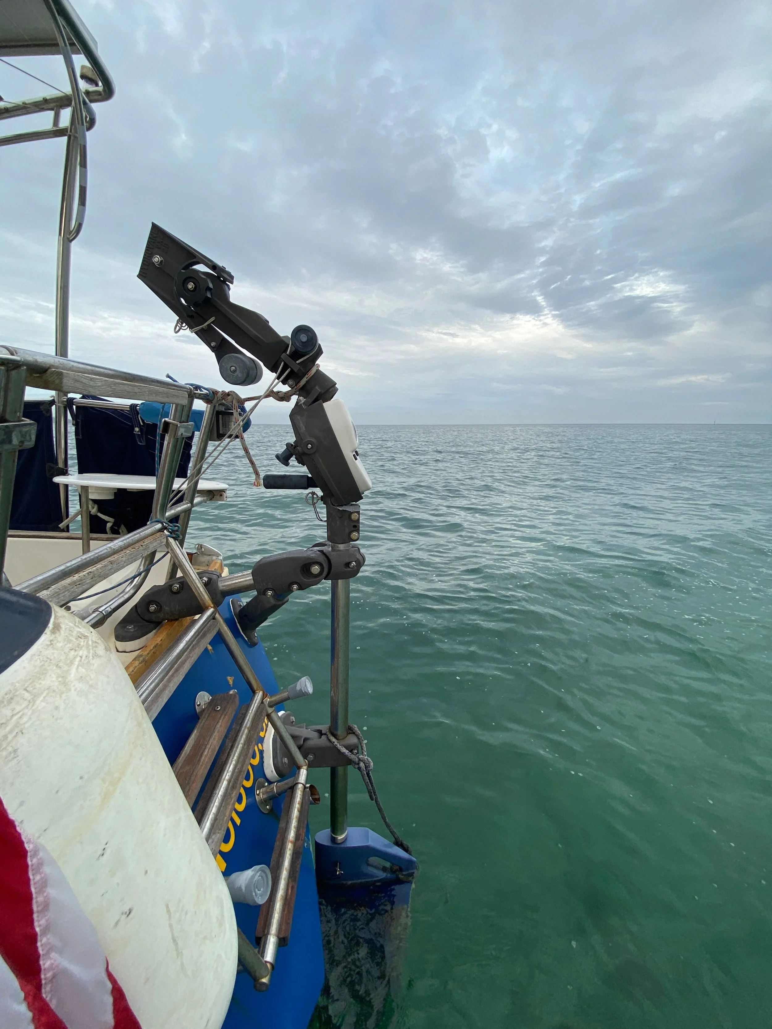
We left San Diego only a few days before the official start of hurricane season, so we have been sailing nonstop to get out of the hurricane zone as quickly as possible. (Hence no stops in Mexico.) I want to cross the ever-shifting ITCZ thunderstorm zone at its narrowest point because lightning is extremely dangerous for a sailboat. I didn’t want to go too far west too soon, since the tradewinds could easily carry me west later if the ITCZ was narrower over there. In addition to hurricane and ITCZ considerations, I wanted to sail as close as possible to a direct course because this is a long passage and I have a limited water supply. I chose the Marquesas islands as our first landfall because they are the furthest east and north, and it will all be downwind sailing from there across the south Pacific.
Every morning, I begin the downloads while I make coffee. (Downloads regularly fail, or the connection drops, so this process is a lesson in patience.) I start by downloading a 72-hour wind, pressure, cloud, and swell forecast (GRIB file) for a 10x10 degree square around me in the highest resolution possible, in four different weather models. I use this to make minor adjustments to my course: deciding if I should go a little more west or south for better conditions, and anticipating when winds may pick up or decline so I can prepare myself to manage sails at the right times (napping when they are steady, so I’ll be awake when they are supposed to build or drop).
After I finish with the GRIBs for our area, I visit forecast web pages, which each take five to ten minutes to load. I check the National Weather Service’s annotated Pacific image forecast, the National Hurricane Center’s High Seas text forecast, NHC’s Eastern North Pacific Tropical Weather Outlook, and then read the corresponding discussion. Sometimes I also download a 7-10 day, low-resolution wind & swell GRIB forecast for the eastern Pacific to observe general trends, paying special attention to the behavior of the ITCZ and any developing lows or highs. I use all of this data to determine what’s likely coming, what is questionable or conflicting in models, and whether I need to adjust anything about my overall approach to this passage. (Between passages, I still do a daily subset of this, so that I can keep improving at forecast interpretation.)
I knew nothing about meteorology before I left for Hawaii less than two years ago, so if I can do this, anyone can. Often I tell nervous but aspiring cruisers that if you are willing to study a little and interested in learning, you’ll pick it up easily along the way and other sailors will always be happy to help. It’s the same approach I try to take to life: no matter what, just stay curious and go after what interests you; people will help you, and then you will help others.
wishing you fair weather, ☔ ☀️
elana, zia, & SV Windfola